There were many decisive struggles in the technology industry over the course of 2012 — from smartphones and tablets to social networks and software.
But of all these, the fight over digital mapping may have been the most important.
Google Maps, once the most dominant product in the industry, is seeing renewed competition from the likes of Nokia and OpenStreetMap. Apple, a company that could do no wrong in the eyes of many loyal fans and customers, released its own widely reviled Maps app and was moved to publicly apologize, so loud was the outcry from users and tech bloggers.
How did we get there, and where are the big players going next? TPM takes a look:
The miles traveled
From 2005 to 2012, Google Maps steadily became the most used digital map service in the world, besting competitors that were once household names, such as Mapquest and Yahoo Maps.
At the beginning of 2012, it looked as though that trend was poised to continue, with Google Maps continuing to offer improvements to its popular features, such as “Street View,” the interactive, 360-panoramic views of roads and buildings captured by special camera-equipped Google cars. Indeed, at that time it seemed Google Maps had commandeered the marketplace for good.
But something unexpected happened: Large companies like Foursquare that previously relied on Google Maps data for their products began switching to a competitor called OpenStreetMap. Often described as the “Wikipedia of maps,” OpenStreetMap is another digital map of the world assembled entirely by unpaid, volunteer cartographers, who now number nearly 1 million (up from just around 500,000 at the end of 2011).
Google Maps appears to have sowed the seeds of the defection on its own, introducing charges for heavy usage of its map data by other companies and developers at the start of 2012. It costs developers and other companies who want to use Google Maps data, between $0.50 and $1.00 for every 1,000 map loads beyond the first 25,000. To put that in perspective, any time a user grabs location data, let alone even opens Google Maps, pings the Google Maps servers for data, counting as one load.
Where we are now
A number of companies are now vying with Google in mapping, while still others are competing in a separate but related service area: That of “point-of-interest” (POI) databases. It’s one thing to have a map showing streets, borders, waterways and other landscape features, and quite another thing entirely to have a full, comprehensive list of all of the various locations — from businesses like restaurants and shops, to local landmarks, to community areas like parks and government buildings — that make up our communities and, in turn, our world.
Both services are related but conceptually different, and while some companies are tackling both at once, others are specializing and working with allies to merge map data and POI data to offer consumers the best possible apps for directions, reviews and local knowledge.
Together, these two areas — maps and POI databases — are going to become hugely important going forward, both for consumers and businesses, as people expect apps to provide them with the most updated, accurate information on their immediate surroundings, and businesses strive to serve up increasingly targeted and personalized advertising and local deals to customers based on the customers’ locations.
Here’s an overview of the major players in both spaces:
Apple Maps

Apple’s first attempt at launching its own map app was, to great degree, a spectacular failure, such that CEO Tim Cook even published a public apology to Apple customers about it less than week after Apple Maps debuted as the default map app for the iPhone and iPad in the new iOS 6 update for those devices.
Apple has pledged its full resources to fixing the major problems consumers complained about — from inaccurate directions, to misplaced, missing or doubled locations, to odd graphics glitches. But when Google Maps released its own, new Google Maps app for download on the iPhone and iPad, users of those Apple devices flocked to it in droves, propelling it to 10 million downloads in just its first 48 hours of release.
While consumers were widely pleased with the new Google Maps app, giving it an exceptionally high rating, it’s not likely that Apple was happy to see it back on the iPhone. After all, Apple and Google had previously worked together on the original Google Maps app for the iPhone, which was the default map app for that device when it first launched in 2007, and also for the iPad when it launched in 2010. But Apple kicked both Google Maps and Google’s default YouTube app off the iPhone and iPad with the iOS 6 release. The maps rebuke was reportedly due to Apple’s insistence that Google provide the same voice guided turn-by-turn navigation for Apple users as Google did for users of its Android operating system. Lo and behold, Google did put those directions back into the new separate Google Maps app, but too late for the companies to maintain their maps partnership.
Apple also fired two executives who reportedly spearheaded its Maps effort, including Scott Forstall, a man once described as Apple founder Steve Jobs’ heir apparent. The question remains, can Apple get its maps back on track in 2013 to give Google a run for its money?
Apple uses map and POI data from a variety of partners, including TomTom, the GPS device company, Yelp and OpenStreetMap. Apple is also reportedly in talks with Foursquare, a location-based social network, to import some of Foursquare’s comprehensive point-of-interest data into Apple Maps to help fix it. How Apple combines this data and who else it turns to will decide the future of Apple Maps.
OpenStreetMap
While Apple floundered, OpenStreetMap soared. The project, which allows anyone with an Internet connection to help edit a giant digital world map comparable to Google Maps, was first started in 2004 by a computer programmer named Steve Coast, but grew only steadily until 2012, when Foursquare, Wikipedia, Apple and other major companies began using it instead of Google Maps.
Several startups, such as MapBox, Skobbler and CartoDB, and government agencies also elected to use OpenStreetMap.
Still, OpenStreetMap’s own open data license, which is so attractive to outsiders because it permits free use, has also made some of these new commercial adopters uneasy, as it demands that anyone who uses or publicly distributes any data from the map also makes that data free and publicly accessible, along with any other “derivative database” built on top it.
So while Foursquare and other startups were only too happy to begin using OpenStreetMap once Google began charging, representatives from said companies showed up at the annual OpenStreetMap State of the Map USA conference in October with concerns and questions for OpenStreetMap’s nonprofit Foundation board members about using the data in their own commercial endeavors. The company representatives said they ideally wanted to see the language clarified to expressly allow them to build proprietary, paid products using OpenStreetMap data without running afoul of the community or the legal standards of the license.
At the time of this article’s publication, OpenStreetMap’s board and community haven’t yet updated their standards, but the commercial companies are continuing to use them. OpenStreetMap’s founder and its Foundation’s chairman emeritus Steve Coast also said he’d be hosting a commercial users’ conference in 2013 to try and resolve some of these issues.
Nokia

Nokia, the company best known for being the dominant player in the cell phone business back in the late 1990s and early 2000s, has struggled in recent years against the rise of the Apple iPhone and Google Android smartphones. But in its back pocket, Nokia has long had a massive digital mapping operation. The company really became a major player in the space after acquiring Chicago geographic information services company Navteq in 2007, taking that company’s data and adding it to its own operation and continuing to improve it.
Nokia in late 2012 announced a massive rebranding of its location services, from Nokia Maps to “Here Maps.”
Nokia’s new maps effort also includes a community-based map editor and similar panoramas and 3D views to those found on Google Maps and Google Street View. The company even beat Google back to the iPhone with its own Here Maps app, which quickly climbed to the top of the most downloaded apps but received mixed to poor reviews.
Still, Nokia has powerful clients, customers and allies when it comes to maps: It powers Microsoft’s Bing Maps, which in turn powers Facebook, and is expanding to cover Amazon’s new Maps API and in 2013, will be behind a new series of smartphones running Mozilla’s upcoming Firefox OS.
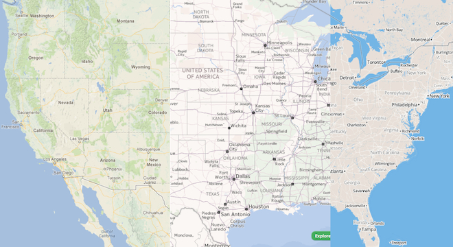
Google Maps
View Larger Map
Google Maps made some of its flashiest improvements in 2012, introducing such useful features as indoor floorplans for its Google Maps website and developer kits, indoor Street-View style panoramas for businesses, and improving Google Maps 45-degree imagery (aerial from an angle), 3D imagery and the overall global map coverage area itself.
Google even took Street View to such little-seen and out-of-the-way places as The White House, Antarctica and even under the sea. As the year went on, Google really did seem to be trying to show just how its mapping products are “more than a map.”
As fun and functional for consumers those new features may be, Google still couldn’t stop developers and its former large clients from defecting due to the sudden move to charge for heavy use of Google Maps data. Google even lowered the prices after “feedback” from customers, but by that time, the ball was already in motion: Developers and other large companies were eager to move away from Google and its ability to implement changes at will to the map data customers rely on, including imposing costs.
Google’s challenge in 2012 is to regain lost ground while at the same time, encourge more widespread adoption and use of its map data by both individual users and larger organizations. Google Maps is said to cost the company over $1 billion dollars a year to maintain, a huge portion of its total disclosed expenses ($13 billion in 2011). That’s both an asset and a hindrance, as Google’s investment is paying off and acts to deter Apple and Nokia, who must spend nearly as much if they want to keep up or exceed Google’s map capabilities.
But OpenStreetMap doesn’t have those associated costs, assembled as it is by volunteers. OpenStreetMap also lacks some of Google’s more eye-catching features and currently, even such critical information as comprehensive address data and routing information for the U.S.
But many developers can and have been implementing these features in their own apps that use OpenStreetMap, and it seems only a matter of time before OpenStreetMap itself has avid volunteers work to add them for free use in some form.
The road ahead
In previous years, maps could have been dismissed as important only to “road warriors,” or those who travel often. But that’s no longer the case.
Digital maps have become an increasingly used feature for most smartphone users, as surveys have shown, and making sure they work correctly is the difference between avid loyalty, as in the case of Google Maps, or widespread dissatisfaction, as in the case of Apple Maps.
Maps power features of some of the most popular apps and websites on the market, from Instagram’s “Photo Map” feature (with a point-of-interest database generated by Foursquare), to Facebook’s new and improved “Nearby” feature unveiled at the end of 2012 (Facebook’s website uses Microsoft and Nokia Maps, but its smartphone app uses the default map app, either Apple Maps for iPhone or Google Maps for Android).
More importantly for businesses, as advertising spending increasingly moves to the Web and to mobile devices, there will be a need for more highly-targeted, localized and personalized advertising.
Digital maps have gone from a useful but non-mandatory feature to the next great driver of digital revenue and a vital resource, especially as more users buy smartphones, and more of those users become dependent on their smartphones for directions and location information.
Maps are to 2013 and beyond what apps were to the period of 2007 to 2012. Making good maps and making good use of maps could decide the fate of many tech companies. Wherever they end up, it will be exciting to follow along.


