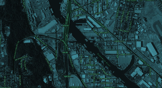
If you want to see the world, MapBox has you covered — for a price. The Washington, D.C.-based company that allows users and other businesses to design and publish their own digital maps, on Tuesday announced the launch of MapBox Satellite, a beautiful, easily customizable, new satellite imagery layer that spans the globe, which can now also be used in its customers’ maps.
The imagery is currently available only through MapBox’s paid service plans, though, which start at $5 per month and include other features such as cloud storage and multiple thousands of map loads, or the ability have many users visit the map.
Still, MapBox anticipates major uptake of its new MapBox Satellite imagery, as CEO Eric Gundersen told TPM via email.
“Our subscribers want the imagery as soon as possible,” Gundersen wrote, later adding. “We are making it a lot easier now for anyone in the government or private sector to quickly integrate imagery into their web app or mobile — and really customize the design.”
But there’s another twist to MapBox’s new MapBox Satellite imagery layer: All of the data comes from free, public domain collections, specifically those assembled by NASA and the USGS using those agencies’ Earth-focused “Landsat” satellites and by the National Agriculture Imagery Program (NAIP), which was a program originally launched by the U.S. Department of Agriculture (USDA)’s Farm Service to keep track of crop levels across the country.
So what MapBox is doing is taking taxpayer-funded imagery, pooling it together, adding its own software that allows users to adjust the colors and even re-label streets as needed, and re-selling it as part of its own products and services.
“The reason for this is that while the raw imagery data used by MapBox Satellite is open and free, we’ve done a lot of investment to turn that data into a usable product for our users,” explained MapBox’s engineering team leader Young Hahn, in an email to TPM. “We’ve done a ton of research and processing to make it look as good as it does and it is definitely non-trivial to scale the infrastructure to store and serve this imagery.”
In many ways, the move is a logical one for MapBox, which launched in 2010 as an offshoot of another firm called Development Seed, and has since achieved success providing maps to such big-name business customers as Foursquare, NPR and Pew Research, among others, using the free map data provided by OpenStreetMap, a crowdsourced competitor to Google Maps and others, with any army of unpaid volunteer contributors now numbering nearly 1 million.
In essence, MapBox’s entire business model is based on taking public domain map resources and adding hours of its own engineering, design and development talent to turn them into products that it or other businesses can easily customize for specific commercial uses.
Indeed, for the case of MapBox Satellite, as MapBox’s Gundersen explained, just because the U.S. government makes its taxpayer funded satellite imagery repositories public domain and free for anyone to use doesn’t mean they are necessarily easily accessible to average users or commercial entities.
“We did everything from having a herd of Buffalo hard drives picking up data around the country to scraping geo-portals state by state (even pulling stuff from the way back machine),” Gundersen wrote of the process to create MapBox Satellite. “As anyone who has tried to get at even just a little NAIP data before knows this is hard. As our government gets serious about open data they need to make sure that access to data is a key part of the data being open.”
MapBox isn’t just a taker though. While the company doesn’t yet have any concrete plans to make MapBox Satellite entirely free in the near future — “we’ve decided to start with satellite at the Basic [$5/month] level for now,” is how Hahn phrased it — it is allowing OpenStreetMap’s volunteer cartographers to use MapBox Satellite to help improve the accuracy of that global map project.
Specifically, MapBox’s Satellite terms of service include the clause: “The ‘Satellite’ layer may be used to produce derivative data for the OpenStreetMap project. All other use for derivative data is prohibited.” Currently, many OpenStreetMap contributors rely on Microsoft Bing Maps satellite data to trace and help improve their map, per a 2010 agreement from Microsoft.
And to be fair, when it comes to commercial digital maps, Mapbox’s more well-known competitor Google Maps also makes use of public satellite data which it turns around and charges for, once users hit a certain heavy usage limit (25,000 map loads).
MapBox’s use of public domain resources as a viable new business tool is just getting started, too: In an official company blog post, Gundersen explained on Tuesday that the current batch of satellite imagery, while global, only supports lower zoom resolutions for now. But Gundersen said increased zoom levels would be coming in early 2013 and then later throughout the year. The Landsat satellite imagery supports zoom resolution down to about 100 feet (30 meters), while the NAIP imagery supports zoom resolution down to 3.3 feet (1 meter).
More importantly, MapBox also plans to begin adding High-Resolution Orthoimagery, among the highest resolution aerial imagery possible and assembled by other U.S. agencies such as the National Oceanic and Atmospheric Administration (NOAA) for hurricane preparedness, to select U.S areas of its MapBox Satellite product in 2013, as well. The HRO imagery goes down to 1 foot zoom resolution.
Correction: This article originally stated that MapBox announced MapBox Satellite on “Wednesday,” when in fact, the company announced the new product on Tuesday, December 4. This article also originally misspelled the word “scraping” as “scrapping.” We have since corrected the errors in copy and regret them.


