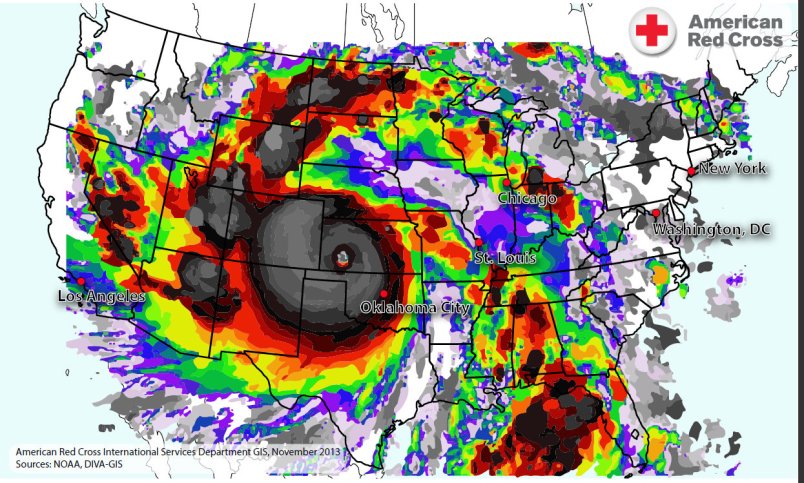
The American Red Cross on Monday released this image of Typhoon Haiyan overlaid on a map of the United States showing how the massive storm would cover nearly the entire country.
Officials have estimated that the typhoon has killed up to 10,000 people in the Philippines this weekend.
Update: According to the New Republic’s Nate Cohn, the image of Haiyan released and tweeted by the American Red Cross seems to be wildly out of proportion.
Late Update: The Red Cross has issued a note:
EDIT 4:51 PM ET: Earlier today, we posted a map of Typhoon Haiyan comparing the size of the storm to geography of the United States. In the process of making the rest of our maps for our operations in the Philippines, we made a mistake with this one and it was not to scale. We always strive to provide the most accurate information possible and we missed the mark with this one-literally. We would like to apologize for this mistake and thank the people who kindly pointed this out to us. We would like to thank everyone for their patience and their continued support of the American Red Cross. We are working on revising the image so it is correct.


