Police in the southern Australian state of Victoria made headlines around the globe earlier this week when they released a safety bulletin online early Monday, warning drivers to “be careful when relying on” Apple Maps, the new default mapping application Apple debuted for the iPhone and iPad in September.
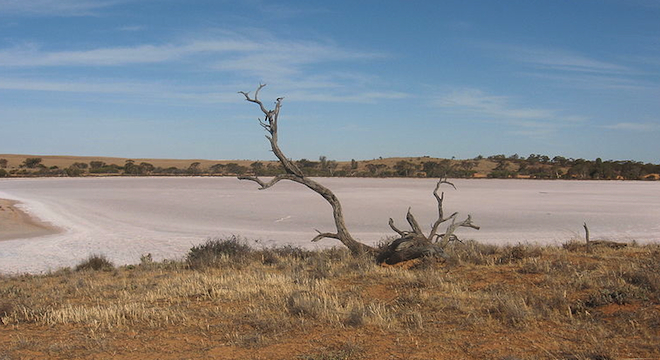
The Victoria Police News report mentioned that a number of “distressed motorists” had become stranded in a rural national park (Murray-Sunset National Park), while following Apple Maps’ directions to the city of Mildura, which, according to Victoria Police, appeared about 43 miles (70 kilometers) away on the Apple Maps view from where it is actually located.
As Victoria Police noted, the situation even proved dangerous given the rural location and the inhospitable weather and climate conditions of the area to which Apple Maps was directing drivers instead of Mildura:
Police are extremely concerned as there is no water supply within the Park and temperatures can reach as high as 46 degrees [114 Fahrenheit], making this a potentially life threatening issue.
Some of the motorists located by police have been stranded for up to 24 hours without food or water and have walked long distances through dangerous terrain to get phone reception.
But now Victoria Police have explained the situation in greater detail to TPM, acknowledging that it appears Apple has “partially fixed” the errors.
“As of this morning (Aus time) the app has been rectified and has placed Mildura in the correct location if you search for a route from Adelaide to Mildura,” wrote Victoria Police media supervisor Leonie Johnson in an email to TPM on Tuesday. “However if you search for a route from Melbourne to Mildura, you will still end up in the desert. So you could say, its been partially fixed.”
The Guardian also reported Monday that Apple had fixed the error, but a quick search on Tuesday using Apple Maps on this reporter’s iPhone 4S and Apple Maps yielded Mildura displayed again incorrectly in the middle of Murray-Sunset National Park, when it should be well northeast (purple pin marking approximate actual location):

Routing from Adelaide to Mildura using Apple Maps also did not provide the correct route:

It’s worth noting though that Apple itself warns drivers to use caution when driving anywhere:

Johnson also clarified to TPM the precise number of those affected by the error so far: 6 individual drivers.
As Johnson explained:
“Victoria Police have received calls from 6 motorists who have become bogged in the sand in the Murray Sunset National park as a result of being directed there by the Apple Map app. Some of these have been rescued by police. Others have been rescued by contacting other forms of assistance such as friends.
On the 24th of November, one victim, a female, drove her sedan into the park and became bogged in the sand. She had to walk a long distance in difficult terrain to gain a mobile signal and call for help. Police attended and recovered her and her vehicle as there were concerns for her welfare. This is typical of several events that have taken place over the past month. If you proceed 10km [6.21 miles] into the park there is no phone coverage and there is a real danger, particularly that no one will know your out there.
We have rescued people from the park that have been trapped there for three days before anyone knew they were even missing.”
Johnson said that Victoria Police would continue to test the Apple Maps app to see if Apple eventually fixes it entirely for the region, but that it was ultimately up to the company to do so and alert users to when it the app is entirely accurate and reliable to use for navigation purposes.
“Victoria Police have contacted Apple via a police only email address and advised of the problem and the urgency attached to it,” Johnson said.
Asked if Victoria Police could suggest an alternative mapping application for drivers in the region to use, Johnson said that wasn’t within the police department’s purview, but that it would be wise for any driver to carry paper maps.
“Victoria Police do not make recommendations in relation to the variety of devices on the market. That’s not our role,” Johnson said. “We do however suggest to people to maintain map books or maps to verify what the GPS is telling them to do if they are in any doubt about what they are doing/seeing.”
It’s worth pointing out that the Murray Sunset National Park’s website offers an embedded map view powered by Microsoft’s Bing Maps (which are in turn powered by Nokia Navteq map data and technology).
Apple may have been led astray in placing the location of Mildura in Apple Maps by a confusing tag originally introduced in the Australian government’s Gazetteer, the authoritative list of place names and geolocation data for the country, which points to the “Mildura Rural City,” a local government office located in the spot that Apple Maps directed users too, according to the Register (via CNET).
TPM reached out to Apple for more information on the issue and when it would be fully resolved, but has yet to receive a response.


